
Chancellor Inlet East Rockfish Conservation Area
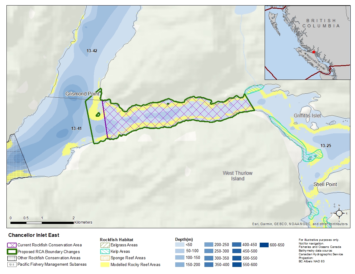
Description of current Rockfish Conservation Area boundary
Those waters of Subarea 13-41 that lie easterly of a line:
| from | 50°26.961'N | 125°35.592'W | Grismond Point |
|---|---|---|---|
| to | 50°26.300'N | 125°35.449'W | shoreline |
Proposed boundary change
Extend western portion of the boundary by up to 500 metres.
Reason(s) for proposed boundary change
- Increase amount of rockfish habitat protected in area.
- Capture habitat at deeper depths.
- Date modified: