
Dickson - Polkinghorne Islands Rockfish Conservation Area
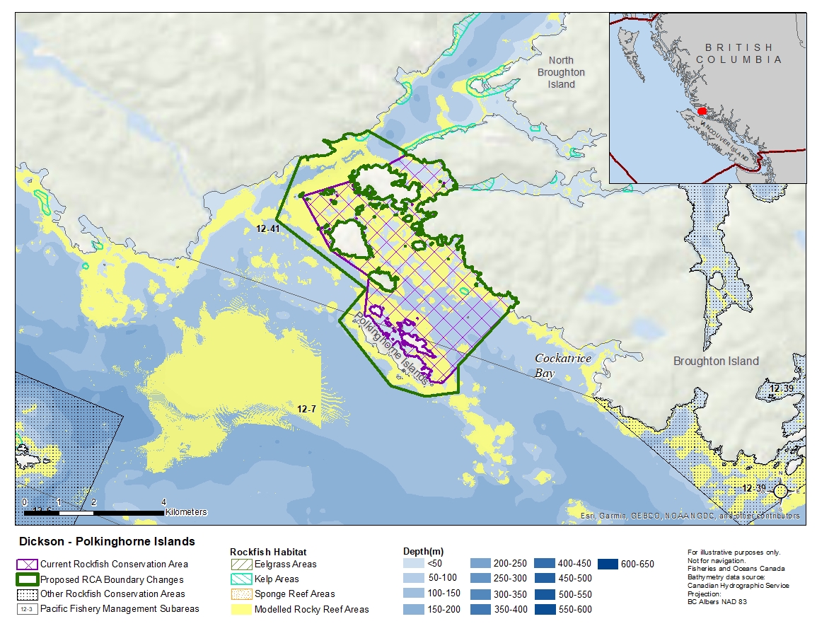
Description of current Rockfish Conservation Area boundary
Those waters of Subareas 12-7 and 12-41 that lie inside a line that:
| begins at | 50°50.050'N | 126°58.100'W | Ommaney Islet |
|---|---|---|---|
| then to | 50°50.300'N | 126°56.850'W | Dickson Island |
| then following the northerly shoreline of Dickson Island to |
50°50.550'N | 126°56.033'W | Dickson Island |
| then to | 50°50.700'N | 126°55.574'W | Bourmaster Point |
| then southerly following the shoreline to |
50°50.225'N | 126°54.300'W | Tidal Rapids |
| then to | 50°50.195'N | 126°54.300'W | Tidal Rapids |
| then southerly following the shoreline to |
50°48.300'N | 126°53.000'W | Card Point |
| then to | 50°47.183'N | 126°54.600'W | Brig Rock |
| then to | 50°47.200'N | 126°54.890'W | Fantome Point |
| then following the northereasterly shoreline of Pokinghorne Islands to |
50°48.216'N | 126°56.541'W | Polkinghorne Islands |
| then to | 50°48.820'N | 126°56.445'W | Vincent Island |
| then to | 50°49.220'N | 126°57.382'W | Percy Island |
then to the beginning point.
Proposed boundary change
- Extend portions of the northwestern boundary by up to 1 kilometre.
- Extend southern portions of the boundary around Polkinghorne Islands Conservancy.
Reason(s) for proposed boundary change
- Capture complete habitat structures.
- Capture habitat at deeper depths.
- Date modified: