
Havannah Channel Rockfish Conservation Area
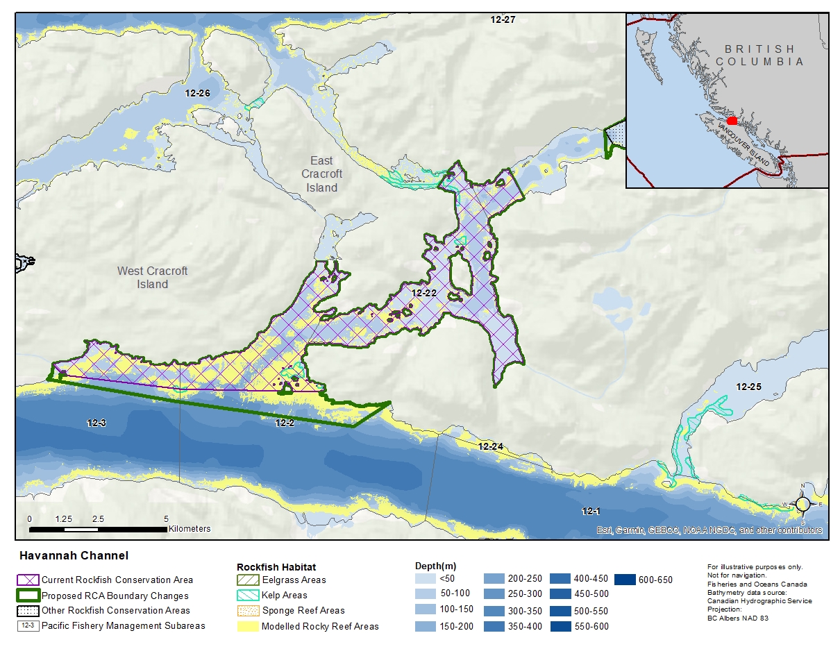
Description of current Rockfish Conservation Area boundary
Those waters of Subareas 12-2, 12-3, 12-22, 12-23 and 12-26 that lie inside a line that:
| begins at | 50°33.250'N | 126°16.757'W | Mist Bluff |
|---|---|---|---|
| then following the Mist Islets to | 50°33.250'N | 126°16.152'W | shoreline |
| then following the southerly shoreline of East Cracroft Island to |
50°34.737'N | 126°13.000'W | west of Root Point |
| then to | 50°35.100'N | 126°12.622'W | Hadley Bay |
| then easterly following the shoreline to | 50°35.100'N | 126°10.821'W | shoreline |
| then through Warren Island to | 50°34.533'N | 126°10.347'W | shoreline |
| then southerly and westerly following the shoreline to |
50°30.700'N | 126°16.649'W | shoreline |
| then through the Broken Islands to | 50°30.739'N | 126°20.993'W | Escape Reef |
| then to | 50°31.000'N | 126°24.571'W | Bush Islets |
| then to | 50°31.200'N | 126°24.915'W | shoreline |
then following the southeasterly shoreline of West Cracroft Island to the beginning point.
Proposed boundary change
Extend portions of the southern boundary by up to 1 kilometre.
Reason(s) for proposed boundary change
- Capture complete habitat structures.
- Capture habitat at deeper depths.
- Date modified: