
Thurston Bay Rockfish Conservation Area
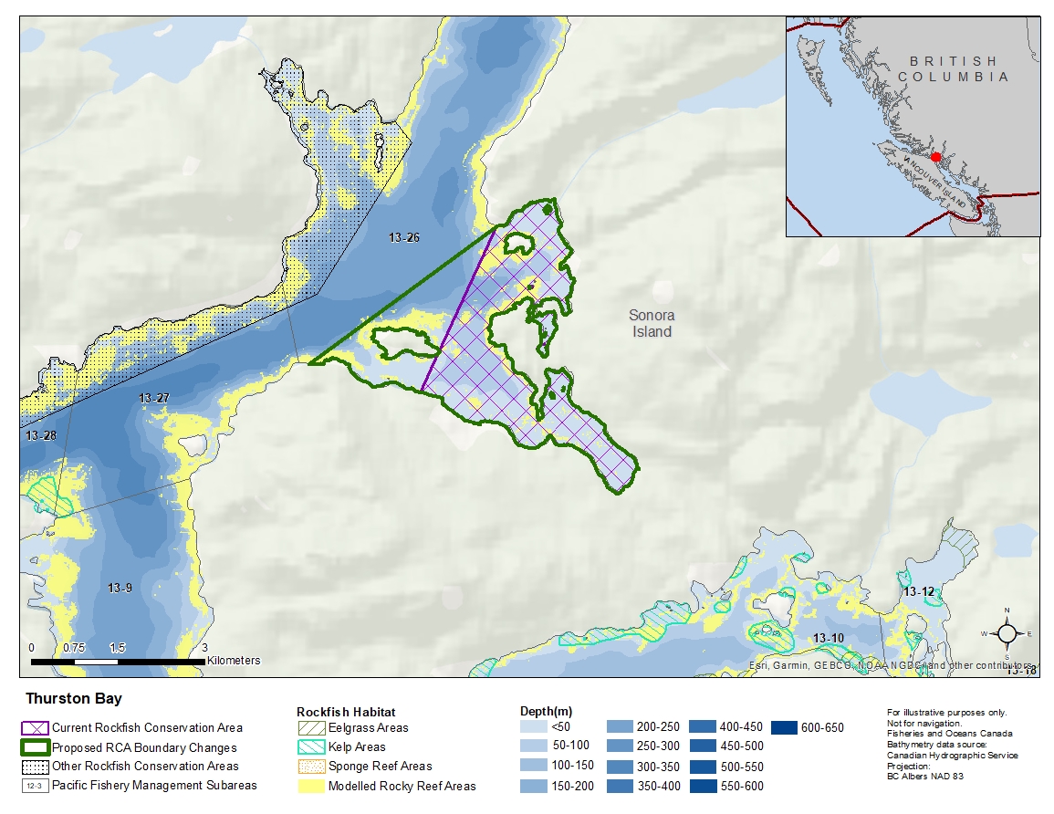
Description of current Rockfish Conservation Area boundary
In Subarea 13-26, the waters of Thurston Bay and Cameleon Harbourthat lie westerly of a line:
| from | 50°22.524'N | 125°19.872'W | Davis Point |
|---|---|---|---|
| to | 50°20.988'N | 125°21.000'W | Sonora Island |
then to the beginning point.
Proposed boundary change
Extend western portions of the boundary up to 1.8 kilometres.
Reason(s) for proposed boundary change
- Increase amount of rockfish habitat protected in area.
- Capture complete habitat structures.
- Capture habitat at deeper depths.
- Date modified: