
Viscount Island Rockfish Conservation Area
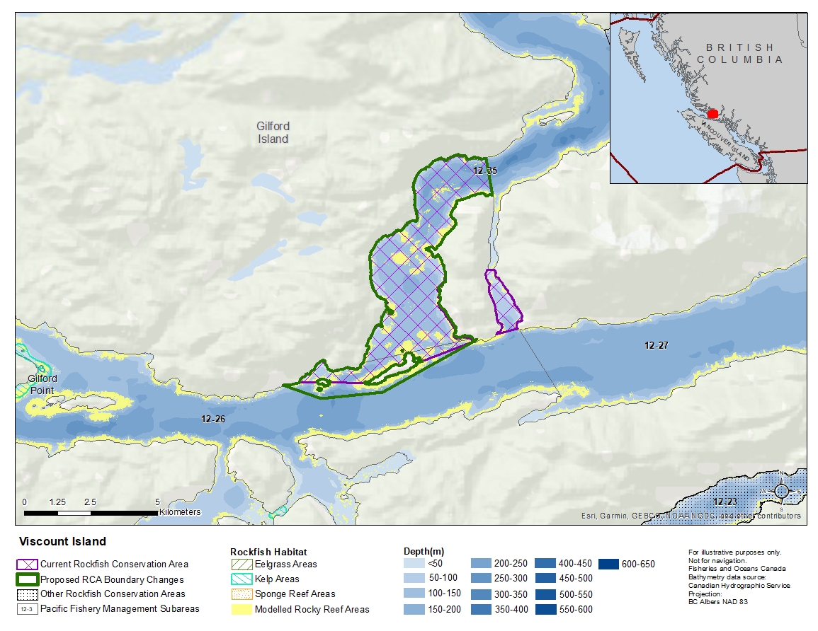
Description of current Rockfish Conservation Area boundary
Those waters of Subareas 12-26 and 12-35 that lie inside a line that:
| begins at | 50°43.552'N | 126°12.127'W | shoreline |
|---|---|---|---|
| then to | 50°42.797'N | 126°11.903'W | Viscount Island |
| then southerly following the Viscount Island shoreline to |
50°41.300'N | 126°12.077'W | Sargeaunt Passage |
| then to | 50°41.300'N | 126°11.833'W | Sargeaunt Passage |
| then southerly following the shoreline to | 50°40.109'N | 126°11.089'W | Steep Head |
| then to | 50°39.993'N | 126°11.794'W | Viscount Island |
| then easterly following the shoreline of Viscount Island to |
50°39.846'N | 126°12.493'W | Viscount Island |
| then to | 50°39.402'N | 126°14.312'W | Shewell Island |
| then following the northerly shoreline of Shewell Island to |
50°38.997'N | 126°15.985'W | Shewell Island |
| then through the Doctor Islets to | 50°39.005'N | 126°18.051'W | Gilford Island |
then northerly following the shoreline to the beginning point.
Proposed boundary change
- Extend portions of the southern boundary by up to 600 metres.
- Remove eastern portion of the boundary near Steep Head.
Reason(s) for proposed boundary change
- Increase amount of rockfish habitat protected in area.
- Capture complete habitat structures.
- Capture habitat at deeper depths.
- Remove areas with small amount of rockfish habitat.
- Date modified: