
Bolivar Passage Rockfish Conservation Area
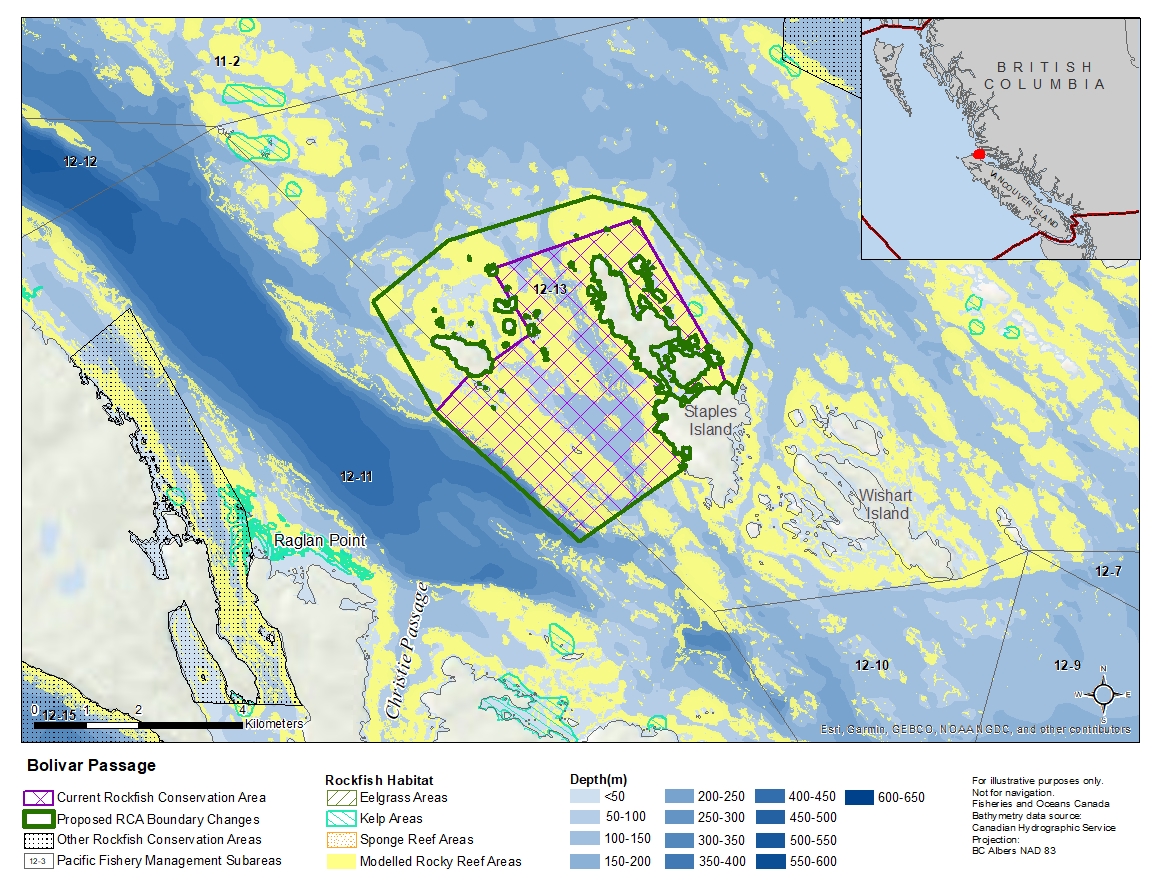
Description of current Rockfish Conservation Area boundary
Those waters of Subareas 12-11 and 12-13 that lie inside a line that:
| begins at | 50°55.100'N | 127°34.928'W | unnamed island |
|---|---|---|---|
| then to | 50°55.651'N | 127°32.603'W | Ragged Rock |
| then to | 50°54.300'N | 127°31.279'W | unnamed island |
| then following the southwesterly shoreline to |
50°54.158'N | 127°31.154'W | unnamed island |
| then to | 50°53.976'N | 127°31.055'W | Staples Island |
| then following the westerly shoreline of Staples Island to |
50°53.100'N | 127°31.664'W | Stapels Island |
| then to | 50°52.300'N | 127°33.400'W | in water |
| then to | 50°53.600'N | 127°35.800'W | in water |
| then to | 50°54.000'N | 127°35.256'W | Redfern Island |
| then following the southerly shoreline of Redfern Island to |
50°54.150'N | 127°34.876'W | Redfern Island |
| then to | 50°54.437'N | 127°34.258'W | unnamed island |
| then following the easterly shoreline to |
50°55.100'N | 127°34.900'W | unnamed island |
then to the beginning point.
Proposed boundary change
- Extend portions of the northern boundary by up to 700 metres.
- Extend portions of the eastern boundary by up to 600 metres.
- Extend portions of the western boundary by up to 3 kilometres.
Reason(s) for proposed boundary change
Capture complete habitat structures.
- Date modified: