
Bond Sound Rockfish Conservation Area
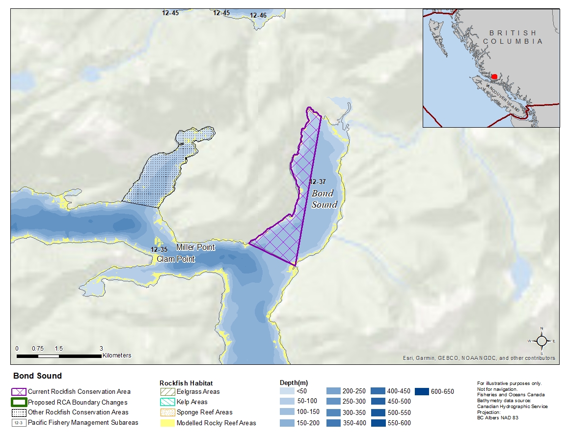
Description of current Rockfish Conservation Area boundary
Those waters of Subarea 12-37 that lie inside a line that:
| begins at | 50°49.964'N | 126°12.941'W | shoreline |
|---|---|---|---|
| then to | 50°49.541'N | 126°11.527'W | Loaf Point |
| then to | 50°52.403'N | 126°10.756'W | shoreline |
then following the shoreline to the beginning point.
Proposed boundary change
Remove Rockfish Conservation Area.
Reason(s) for proposed boundary change
Remove areas with small amount of rockfish habitat.
- Date modified: