
Browning Passage - Hunt Rock Rockfish Conservation Area
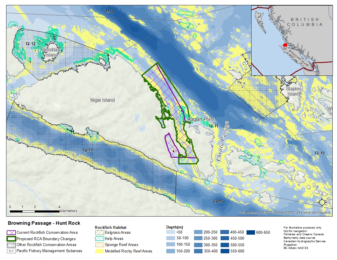
Description of current Rockfish Conservation Area boundary
Those waters of Subarea 12-11 that lie inside a line that:
| begins at | 50°54.079'N | 127°41.817'W | Nigei Island |
|---|---|---|---|
| then to | 50°54.600'N | 127°40.867'W | in water |
| then to | 50°52.533'N | 127°38.885'W | Cardigan Rocks |
| then to | 50°52.071'N | 127°38.737'W | Raglan Point |
| then to | 50°50.534'N | 127°37.879'W | Balaklava Island |
| then to | 50°50.534'N | 127°39.641'W | Nigei Island |
then following the shoreline in a northwesterly direction to the beginning point.
Proposed boundary change
- Extend portions of the eastern boundary by up to 500 metres.
- Extend portions of the southern boundary by up to 500 metres.
- Remove a portion of the boundary in Port Alexander Inlet.
Reason(s) for proposed boundary change
- Increase amount of rockfish habitat protected in area.
- Capture complete habitat structures.
- Capture habitat at deeper depths.
- Remove areas with small amount of rockfish habitat.
- Date modified: