
Burley Bay - Nepah Lagoon Rockfish Conservation Area
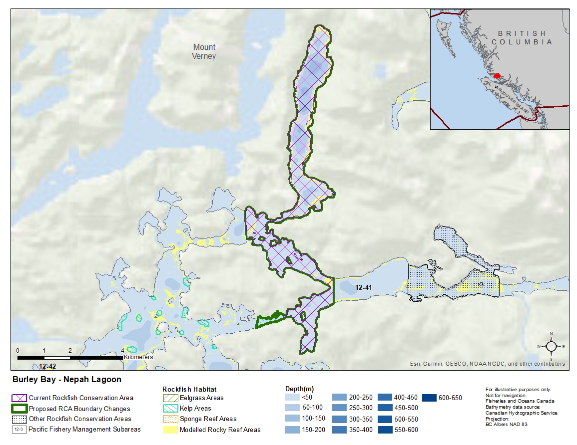
Description of current Rockfish Conservation Area boundary
Those waters of Subarea 12-41 that lie inside a line that:
| begins at | 50°56.056'N | 126°46.500'W | shoreline |
|---|---|---|---|
| then to | 50°55.541'N | 126°46.500'W | shoreline |
| then westerly following the shoreline to |
50°55.224'N | 126°48.100'W | Hopetown Passage |
| then to | 50°55.287'N | 126°48.100'W | Watson Island |
| then following the easterly shoreline of Watson Island to |
50°56.858'N | 126°49.332'W | shoreline |
| then to | 50°57.417'N | 126°49.407'W | shoreline |
then following the shoreline around Nepah Lagoon to the beginning point.
Proposed boundary change
Extend southwestern portion of the boundary by up to 1 kilometre.
Reason(s) for proposed boundary change
Increase amount of rockfish habitat protected in area.
- Date modified: