
Cracroft Point South - Sophia Islands Rockfish Conservation Area
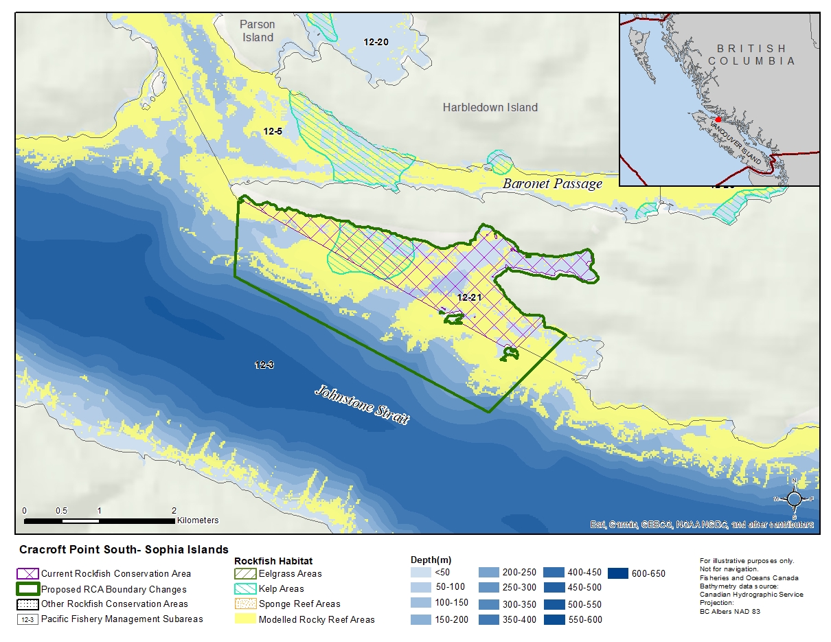
Description of current Rockfish Conservation Area boundary
Those waters of Subareas 12-3 and 12-21 that lie inside a line that:
| begins at | 50°32.033'N | 126°37.188'W | south of Growler Cove |
|---|---|---|---|
| then to | 50°31.808'N | 126°37.526'W | Sophia Islands |
| then to | 50°32.889'N | 126°40.633'W | Cracroft Point |
then easterly following the shoreline to the beginning point.
Proposed boundary change
- Extend southern portion of the boundary by up to 900 metres.
- Extend eastern portion of the boundary by up to 350 metres.
Reason(s) for proposed boundary change
- Capture complete habitat structures.
- Capture habitat at deeper depths.
- Date modified: