
Eden-Bonwick-Midsummer-Swanson Islands Rockfish Conservation Area
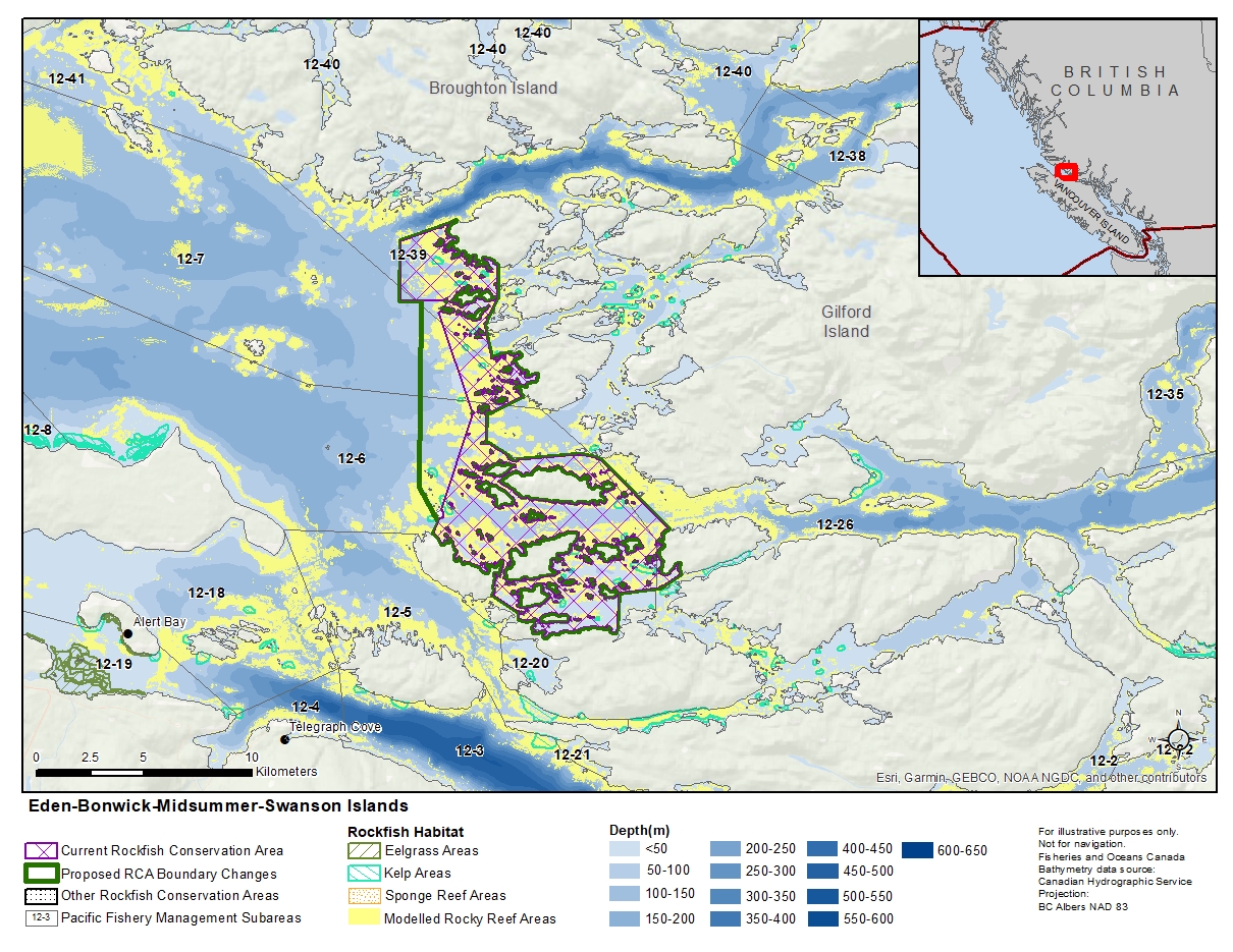
Description of current Rockfish Conservation Area boundary
Those waters of Subareas 12-6, 12-7, 12-26 and 12-39 that lie inside a line that:
| begins at | 50°45.000'N | 126°45.000'W | in water |
|---|---|---|---|
| then to | 50°45.510'N | 126°42.831'W | Duff Point |
| then southerly following the shoreline of Eden Island to |
50°44.402'N | 126°41.178'W | Eden Island |
| then to | 50°43.613'N | 126°41.170'W | Crib Island |
| then to | 50°42.933'N | 126°41.656'W | Hudson Island |
| then to | 50°42.095'N | 126°41.386'W | unnamed islet |
| then to | 50°42.236'N | 126°40.661'W | west of Betty Cove |
| then southerly following the shoreline of Bonwick Island to |
50°41.135'N | 126°40.152'W | west of Success Point |
| then to | 50º 40.756'N | 126º 41.353'W | Sedge Island |
| then following the northerly shoreline of Sedge Island to |
50º 40.667'N | 126º 41.568'W | Sedge Island |
| then to | 50°40.000'N | 126°41.600'W | Canoe Islets |
| then to | 50°39.667'N | 126°40.674'W | Wolf Island |
| then following the southerly shoreline of Wolf Island to |
50°39.549'N | 126°40.292'W | Wolf Island |
| then to | 50°39.700'N | 126°37.900'W | Morning Islets |
| then to | 50°39.600'N | 126°37.100'W | Gilford Island |
| then to | 50°37.867'N | 126°34.350'W | Warr Bluff |
| then following the westerly shoreline of Village Island to |
50°36.715'N | 126°33.863'W | Village Island |
| then to | 50°36.386'N | 126°34.628'W | Hail Islets |
| then to | 50°36.245'N | 126°36.275'W | Alder Island |
| then to | 50°35.331'N | 126°36.337'W | Harbledown Island |
| then westerly following the shoreline of Harbledown Island to |
50°35.555'N | 126°40.206'W | Whitebeach Passage |
| then to | 50°35.737'N | 126°40.202'W | Sarah Islets |
| then to | 50°36.170'N | 126°41.222'W | Stoker Point |
| then northerly and westerly following the shoreline of Swanson Island to |
50°37.691'N | 126°43.572'W | Swanson Island |
| then to | 50°38.075'N | 126°43.339'W | Wedge Island Light |
| then following the easterly shoreline of Wedge Island to |
50°38.310'N | 126°43.273'W | Wedge Island |
| then to | 50°40.700'N | 126°42.100'W | Sedge Islands |
| then to | 50°43.200'N | 126°43.467'W | near Kate Islet |
| then to | 50°43.500'N | 126°43.100'W | near Crib Island |
| then to | 50°43.500'N | 126°45.000'W | in water |
then to the beginning point.
Proposed boundary change
- Extend portions of the western boundary by up to 2.4 kilometres.
Reason(s) for proposed boundary change
- Capture complete habitat structures.
- Capture habitat at deeper depths.
- Date modified: