
Frederick Island Rockfish Conservation Area
No boundary change proposed at this time.
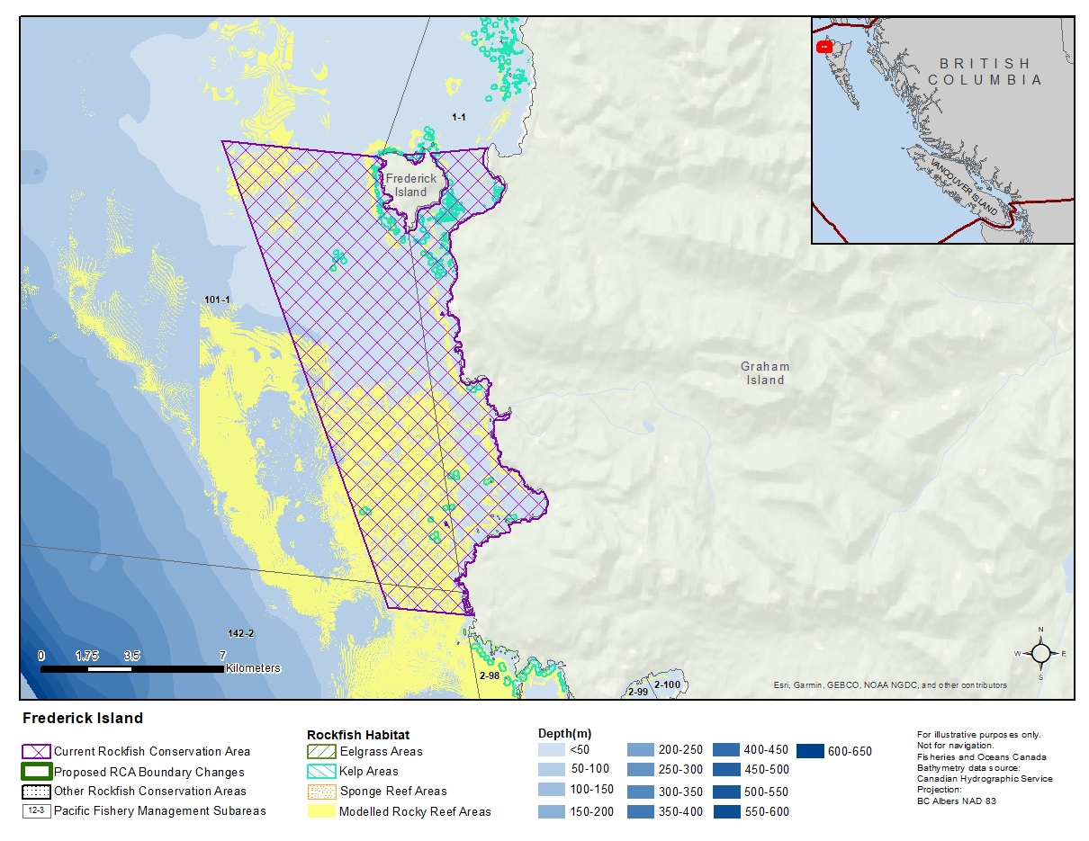
Description of current Rockfish Conservation Area boundary
Those waters of Subareas 1-1, 101-1 and 142-2 that lie inside a line that:
| begins at | 53°56.246’N | 133°17.500’W | in water |
|---|---|---|---|
| then to | 53°56.246’N | 133°11.862’W | Hope Point |
| then to | 53°56.737’N | 133°08.036’W | Morgan Point |
| then southerly following the shoreline of Graham Island to the intersection with the parallel passing through 53°47.000’ north latitude, | |||
| then to | 53°47.000’N | 133°10.000’W | in water |
then to the beginning point.
- Date modified: