
Gull Rocks North and Gull Rocks South Rockfish Conservation Areas
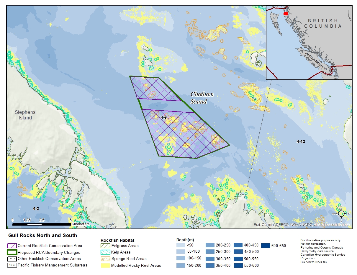
Description of current Rockfish Conservation Area boundary
Gull Rocks North
Those waters of Subarea 4-9 that lie inside a line that:
| begins at | 54°11.300'N | 130°34.600'W | in water |
|---|---|---|---|
| then to | 54°11.300'N | 130°32.300'W | in water |
| then to | 54°10.300'N | 130°30.400'W | in water |
| then to | 54°10.300'N | 130°33.900'W | in water |
then to the beginning point.
Gull Rocks South
Those waters of Subarea 4-9 that lie inside a line that:
| begins at | 54°09.800'N | 130°33.500'W | in water |
|---|---|---|---|
| then to | 54°09.800'N | 130°29.300'W | in water |
| then to | 54°08.400'N | 130°26.400'W | in water |
| then to | 54°07.700'N | 130°28.900'W | in water |
| then to | 54°07.700'N | 130°31.900'W | in water |
then to the beginning point.
Proposed boundary change
Extend boundaries to combine two RCAs into one new RCA.
Reason(s) for proposed boundary change
- Capture deeper depths.
- Capture complete habitat structures.
- Date modified: