
Haddington Passage Rockfish Conservation Area
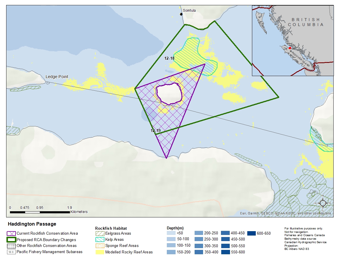
Description of current Rockfish Conservation Area boundary
Those waters of Subarea 12-18 and 12-19 that lie inside a line that:
| begins at | 50°36.155'N | 127°02.297'W | Neill Ledge Buoy |
|---|---|---|---|
| then to | 50°36.600'N | 127°00.400'W | Haddington Reefs |
| then to | 50°34.969'N | 127°01.411'W | Broad Point Light |
Proposed boundary change
- Extend portions of the northern boundary by up to 1.5 kilometres.
- Extend portions of the eastern boundary by up to 2.8 kilometers.
- Remove portions of the southern boundary by up to 850 metres.
Reason(s) for proposed boundary change
- Increase amount of rockfish habitat protected in area.
- Capture complete habitat structures.
- Remove areas with small amount of rockfish habitat.
- Date modified: