
Hodgson Reefs Rockfish Conservation Area
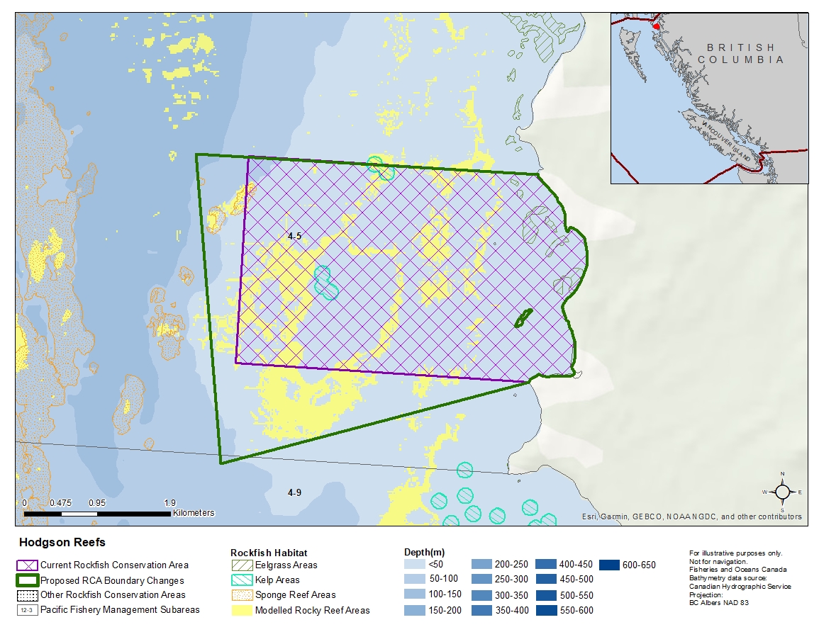
Description of current Rockfish Conservation Area boundary
Those waters of Subarea 4-5 that lie inside a line that:
| begins at | 54°23.900'N | 130°32.600'W | in water |
|---|
then true east to the shore, then southerly following the shoreline to the intercept with the parallel passing through 54°22.450' north latitude,
| then to | 54°22.450'N | 130°32.600'W | in water |
|---|
then to the beginning point.
Proposed boundary change
- Extend southern portion of the boundary by up to 1 kilometre.
- Extend western portion of the boundary by up to 700 metres.
Reason(s) for proposed boundary change
- Increase amount of rockfish habitat protected in area.
- Capture complete habitat structures.
- Capture habitat at deeper depths.
- Date modified: