
Mackenzie - Nimmo Rockfish Conservation Area
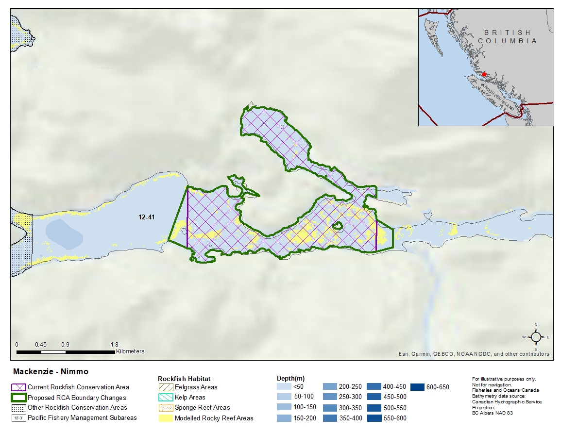
Description of current Rockfish Conservation Area boundary
Those waters of Subarea 12-41 that lie inside a line that:
| begins at | 50°56.363'N | 126°41.100'W | shoreline |
|---|---|---|---|
| then to | 50°56.261'N | 126°41.100'W | shoreline |
| then southerly following the shoreline to | 50°56.045'N | 126°41.100'W | shoreline |
| then to | 50°55.726'N | 126°41.100'W | shoreline |
| then westerly following the shoreline to | 50°55.737'N | 126°44.068'W | shoreline |
| then through Turner Island to | 50°56.360'N | 126°44.068'W | shoreline |
then following the shoreline around Stirling Point, Nimmo Point and Nimmo Bay to the beginning point.
Proposed boundary change
Extend western and eastern portions of the boundary by up to 300 metres.
Reason(s) for proposed boundary change
Capture complete habitat structures.
- Date modified: