
Maud Island and Menzies Bay Rockfish Conservation Areas
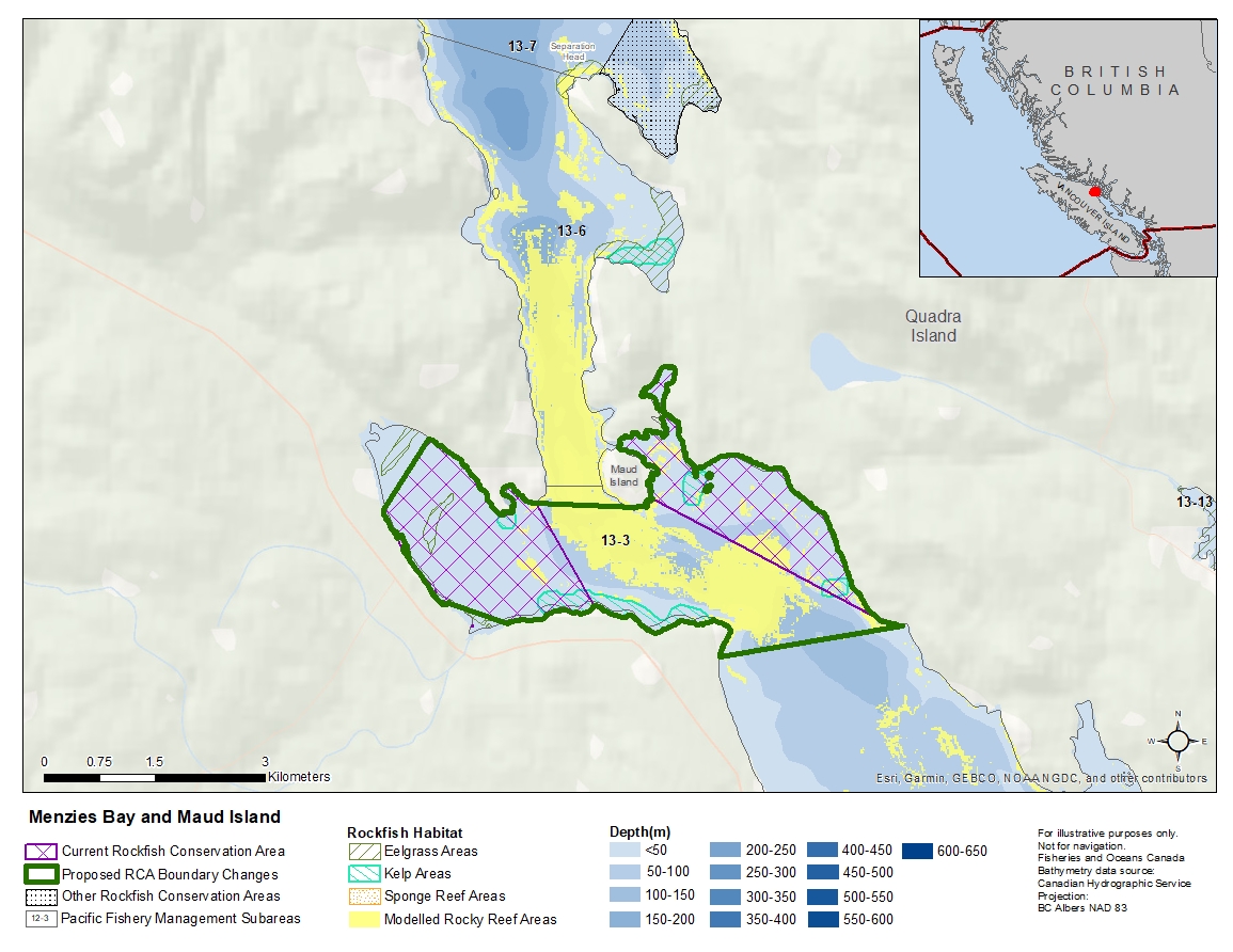
Description of current Rockfish Conservation Area boundary
Maud Island
Those waters of Subarea 13-3 that lie northerly of a line:
| from | 50°07.733'N | 125°20.328'W | near Maud Island Light |
|---|---|---|---|
| to | 50°06.867'N | 125°17.833'W | Quadra Island |
Menzies Bay
Those waters of Subarea 13-3 that lie inside of a line that:
| begins at | 50°07.715'N | 125°21.662'W | Wilfred Point |
|---|---|---|---|
| then to | 50°06.953'N | 125°21.003'W | west of Race Point |
| then to | 50°06.826'N | 125°22.000'W | Huntingford Point |
| then to | 50°06.982'N | 125°22.663'W | Bloedel Wharf |
| then westerly following the shoreline to | 50°07.674'N | 125°23.400'W | shoreline |
| then to | 50°08.188'N | 125°22.874'W | shoreline |
Proposed boundary change
Extend boundaries to combine two RCAs into one new RCA.
Reason(s) for proposed boundary change
- Increase amount of rockfish habitat protected in area.
- Capture complete habitat structures.
- Capture habitat at deeper depths.
- Date modified: