
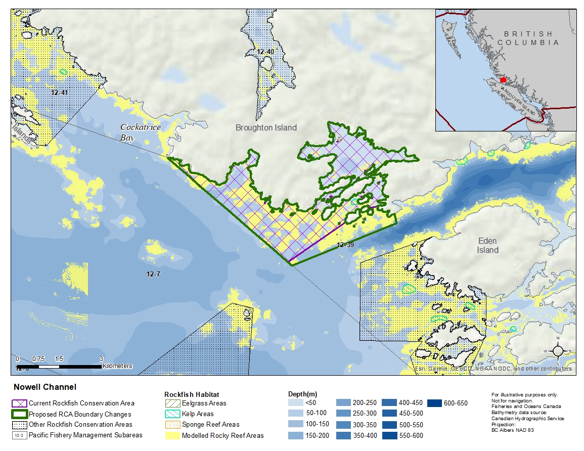
Nowell Channel Rockfish Conservation Area
Description of current Rockfish Conservation Area boundary
Those waters of Subarea 12-39 that lie inside a line that:
| begins at | 50°46.083'N | 126°44.505'W | North of Gordon Point |
|---|---|---|---|
| then to | 50°46.058'N | 126°44.774'W | unnamed island |
| then following the northerly shoreline to |
50°46.016'N | 126°45.015'W | unnamed island |
| then to | 50°46.010'N | 126°45.048'W | unnamed island |
| then following the northerly shoreline to |
50°45.782'N | 126°45.471'W | unnamed island |
| then to | 50°45.000'N | 126°47.200'W | in water |
| then to | 50°46.973'N | 126°50.891'W | Gawler Point |
then easterly following the shoreline around Booker Lagoon to the beginning point.
Proposed boundary change
Extend southeastern portion of the boundary by up to 800 metres.
Reason(s) for proposed boundary change
- Capture complete habitat structures.
- Capture habitat at deeper depths.
- Date modified: