
Octopus Islands to Hoskyn Channel Rockfish Conservation Area
No boundary change proposed at this time.
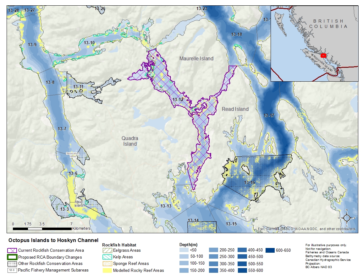
Description of current Rockfish Conservation Area boundary
Those waters of Subareas 13-12, 13-13 and 13-18 that lie southerly of a line:
| from | 50°17.583'N | 125°13.488'W | Hole in the Wall |
|---|---|---|---|
| to | 50°17.750'N | 125°12.655'W | shoreline |
| then following the southerly shoreline of Maurelle Island to |
50°16.587'N | 125°05.343'W | north of Etta Point |
and northerly of a line:
| from | 50°08.604'N | 125°09.144'W | south of Dunsterville Point |
|---|---|---|---|
| to | 50°09.904'N | 125°09.659'W | Quadra Island |
- Date modified: