
Read - Cortes Islands Rockfish Conservation Area
No boundary change proposed at this time.
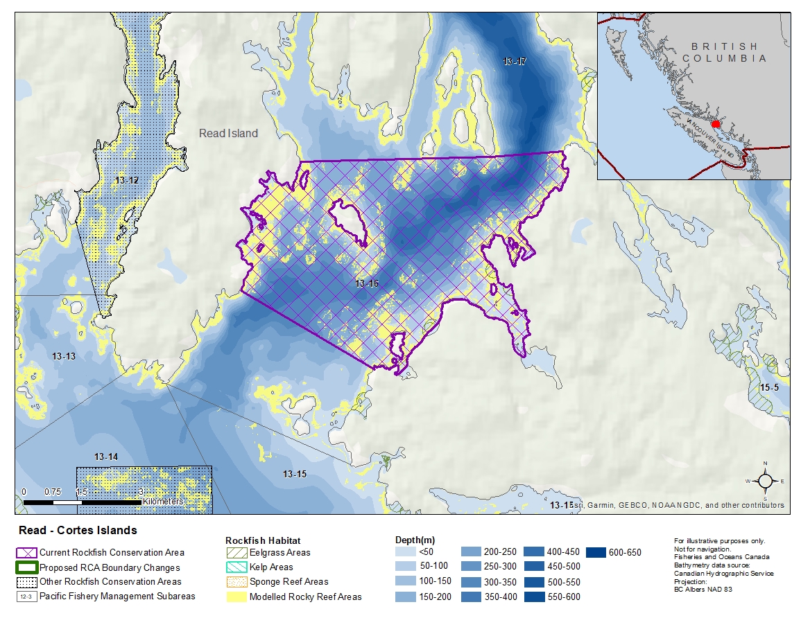
Description of current Rockfish Conservation Area boundary
The waters of Subarea 13-16 that lie southerly of a line that:
| begins at | 50°10.693′N | 125°04.808′W | [Evans Bay] |
|---|---|---|---|
| then to | 50°10.719′N | 125°00.700′W | [Penn Island] |
| then to | 50°10.781′N | 124°59.151′W | [entrance to Von Donop Inlet] |
and northeasterly of a line:
| from | 50°08.917'N | 125°06.116'W | north of Twin Bay |
|---|---|---|---|
| to | 50°07.800'W | 125°03.268'W | south of Coulter Bay |
- Date modified: