
Salmon Channel Rockfish Conservation Area
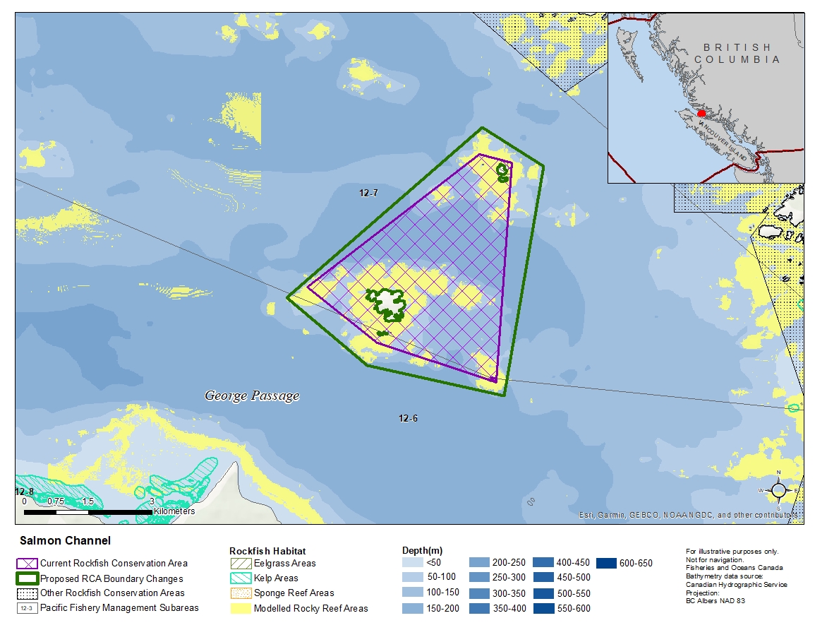
Description of current Rockfish Conservation Area boundary
Those waters of Subareas 12-6 and 12-7 that lie inside a line that:
| begins at | 50°42.500'N | 126°52.300'W | near Foster Rock |
|---|---|---|---|
| then to | 50°44.200'N | 126°48.900'W | near Holford Rocks |
| then to | 50°44.100'N | 126°48.250'W | near Holford Islets |
| then to | 50°41.325'N | 126°48.504'W | near Penfold Islet |
| then to | 50°41.800'N | 126°50.900'W | near Twin Islets |
then to the beginning point.
Proposed boundary change
Extend portions of the boundary to the north, south, east and west by up to 750 metres.
Reason(s) for proposed boundary change
- Capture complete habitat structures.
- Capture habitat at deeper depths.
- Date modified: