
Shelter Bay Rockfish Conservation Area
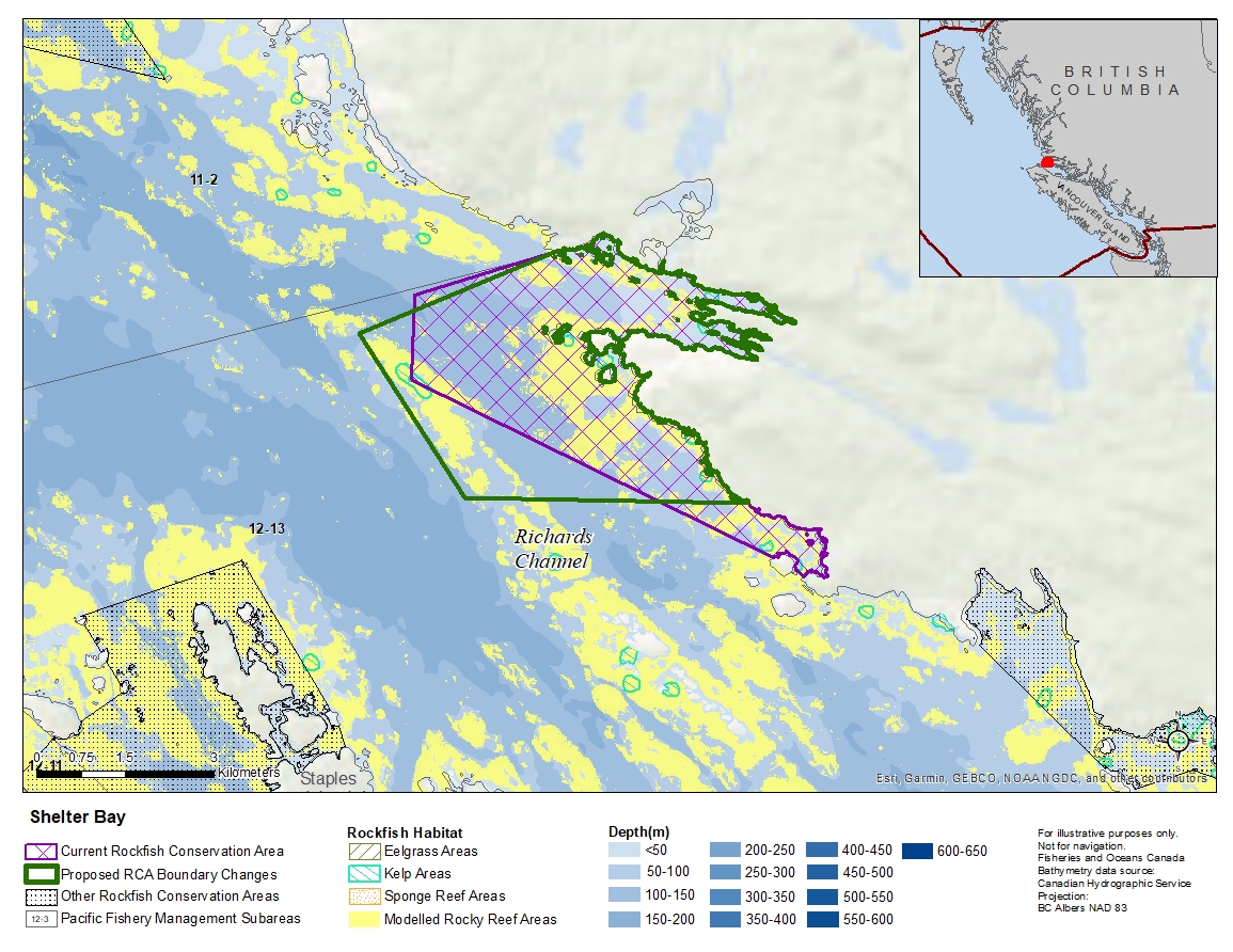
Description of current Rockfish Conservation Area boundary
Those waters of Subarea 12-13 that lie inside a line that:
| begins at | 50°55.611'N | 127°24.481'W | shoreline |
|---|---|---|---|
| then to | 50°55.669'N | 127°24.617'W | Robertson Island |
| then following the northerly shoreline of Robertson Island to |
50°55.774'N | 127°24.940'W | Robertson Island |
| then to | 50°57.331'N | 127°30.223'W | Wentworth Rock |
| then to | 50°58.100'N | 127°30.200'W | in water |
| then to | 50°58.520'N | 127°28.155'W | Westcott Point |
then southerly following the shoreline to the beginning point.
Proposed boundary change
- Extend western and southern portions of the boundary by up to 1.6 kilometres.
- Remove northwestern and southeastern portions of the boundary by up to 2.4 kilometres.
Reason(s) for proposed boundary change
- Increase amount of rockfish habitat protected in area.
- Capture habitat at deeper depths.
- Remove areas with small amount of rockfish habitat.
- Date modified: