
Topknot Rockfish Conservation Area
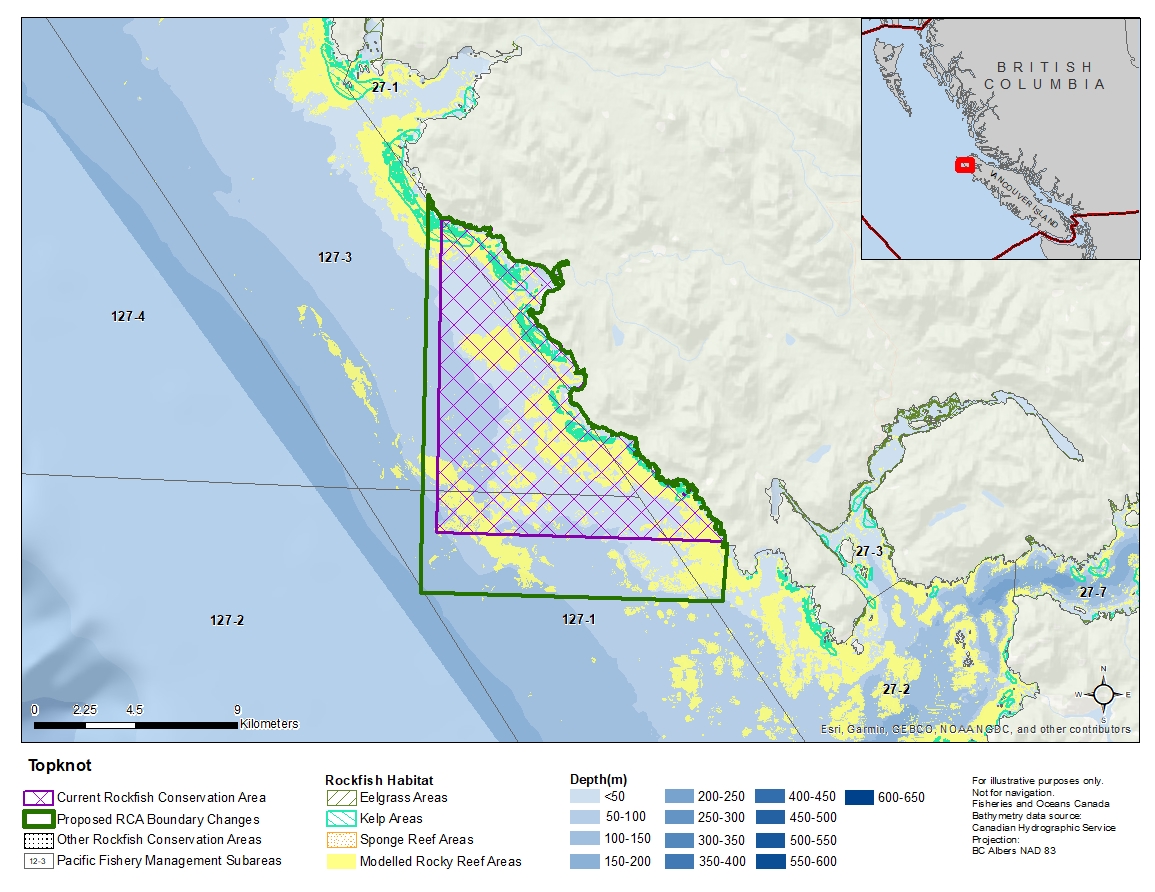
Description of current Rockfish Conservation Area boundary
Those waters of Subareas 27-1, 27-2, 127-1 and 127-3 that lie inside a line that begins at the intersection of the westerly shoreline of Vancouver Island with the parallel passing through 50°29.000' north latitude, then true west to the intersection with the meridian passing through 128°18.000' west longitude, then true north to Cape Palmerston, then southerly following the shoreline of Vancouver Island to the beginning point.
Proposed boundary change
- Extend western portion of the boundary by up to 650 metres.
- Extend southern portion of the boundary by up to 2.7 kilometres.
Reason(s) for proposed boundary change
- Capture habitat at deeper depths.
- Capture complete habitat structures.
- Date modified: