
Upper Call Inlet Rockfish Conservation Area
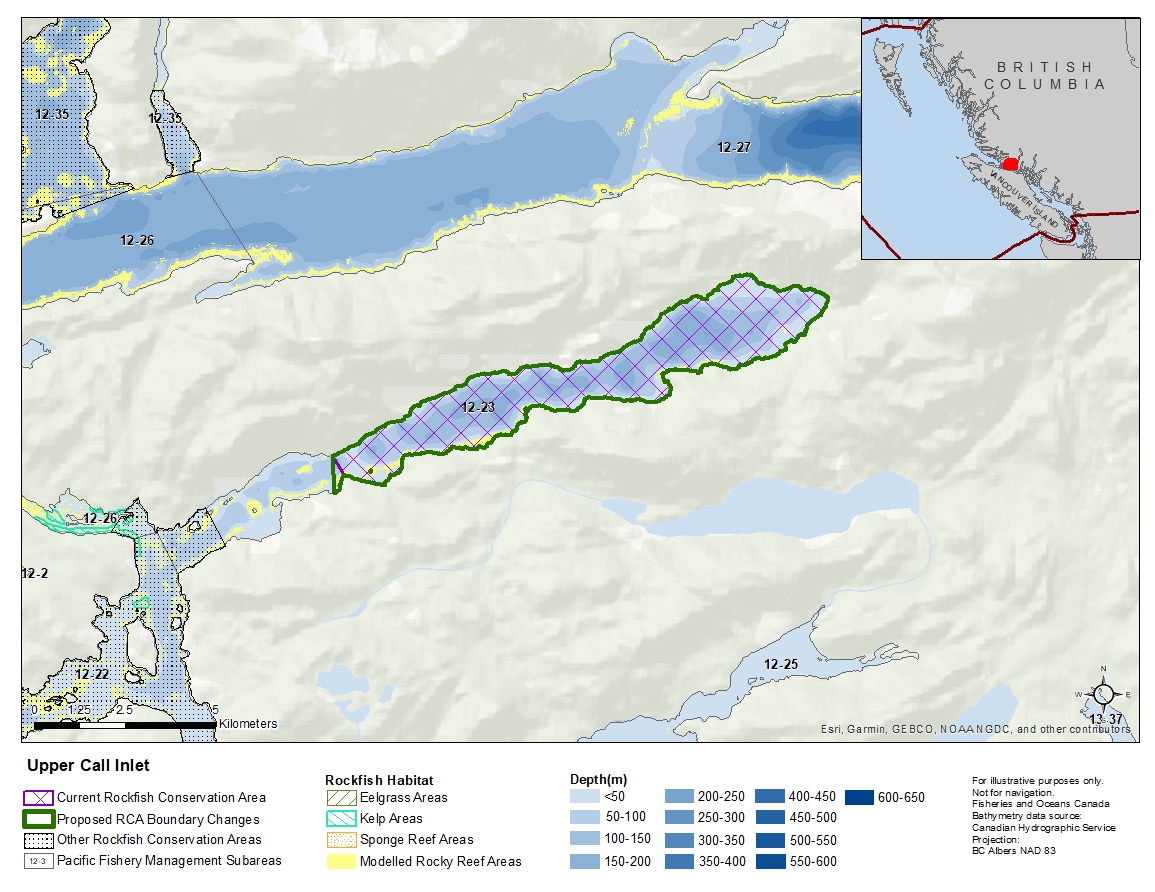
Description of current Rockfish Conservation Area boundary
Those waters of Subarea 12-23 that lie easterly of a line that:
| begins at | 50°35.874'N | 126°07.855'W | shoreline |
|---|---|---|---|
| then to | 50°35.581'N | 126°07.567'W | shoreline |
then to the beginning point.
Proposed boundary change
Extend portion of the western boundary by up to 500 metres.
Reason(s) for proposed boundary change
- Capture complete habitat structures
- Capture habitat at deeper depths
- Date modified: