
Walkem Island to Hemming Bay Rockfish Conservation Area
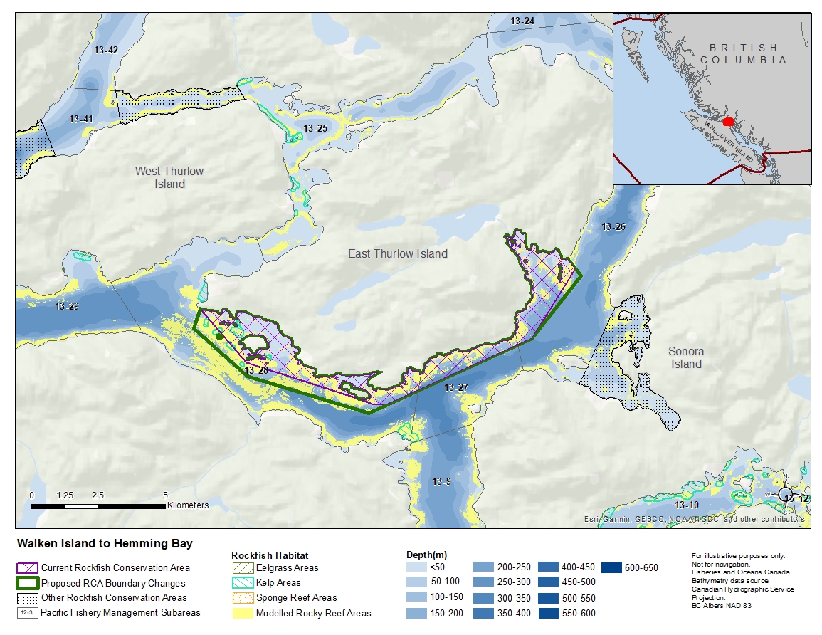
Description of current Rockfish Conservation Area boundary
Those waters of Subareas 13-26 to 13-28 that lie inside a line that:
| begins at | 50°22.534'N | 125°32.929'W | Edith Point |
|---|---|---|---|
| then to | 50°21.457'N | 125°31.511'W | Walkem Islands Light |
| then to | 50°20.707'N | 125°27.930'W | Turn Islands Light |
| then to | 50°20.600'N | 125°27.500'W | in water |
| then to | 50°20.600'N | 125°27.100'W | in water |
| then to | 50°21.900'N | 125°22.500'W | in water |
| then to | 50°23.300'N | 125°21.100'W | in water |
| then to | 50°23.506'N | 125°21.349'W | Jackson Point |
then westerly following the shoreline to the beginning point.
Proposed boundary change
- Extend portions of the southwestern boundary by up to 650 metres.
- Extend portions of the eastern boundary by up to 340 metres.
Reason(s) for proposed boundary change
- Capture complete habitat structures.
- Capture habitat at deeper depths.
- Date modified: