
Weynton Passage Rockfish Conservation Area
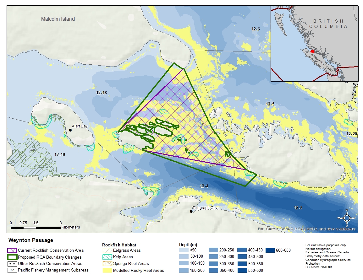
Description of current Rockfish Conservation Area boundary
Those waters of Subareas 12-13, 12-4 and 12-18 that lie inside a line that:
| begins at | 50°37.122'N | 126°49.800'W | Donegal Head |
|---|---|---|---|
| then to | 50°35.200'N | 126°48.324'W | Ksuiladas Island |
| then to | 50°34.294'N | 126°47.250'W | Hanson Island |
| then following the westerly shore of Hanson Island to |
50°33.867'N | 126°46.533'W | Hanson Island |
| then to | 50°34.467'N | 126°51.833'W | Pearse Islands |
| then following the northerly shore of Pearce Island to |
50°35.033'N | 126°53.133'W | Pearse Islands |
then to the beginning point.
Proposed boundary change
- Extend portions of the northwestern boundary by up to 650 metres.
- Extend portions of the southern boundary by up to 1 kilometre.
Reason(s) for proposed boundary change
- Capture complete habitat structures.
- Capture habitat at deeper depths.
- Date modified: