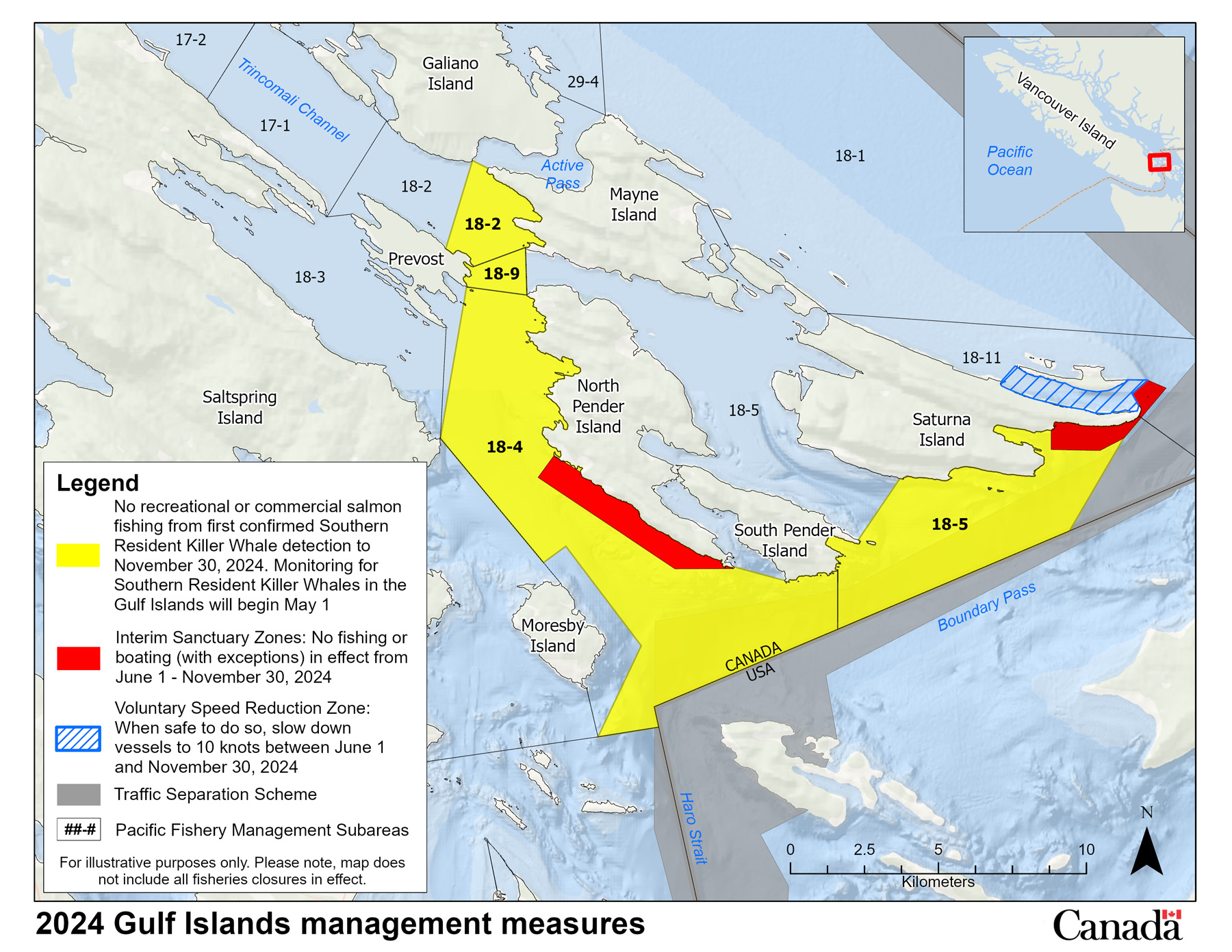
Map of management measures in the Gulf Islands to support Southern Resident killer whale recovery
Release date: May 2024

- Jun 1 to Nov 30: No vessels or fishing (with some exceptions) in the Interim Sanctuary Zones located in a portion of Subarea 18-4 and in portions of 18-5 and 18-11. Human-powered vessels (kayaks, canoes, etc.) may use a 20 m transit corridor along the shoreline. Specific coordinates can be found in FN0469
- NEW Voluntary Speed Reduction Zone: From June 1 to Nov 30, reduce speed to no more than 10 knots in Tumbo Channel, when safe to do so.
- May 8 until Nov 30: No recreational or commercial salmon fishing in Subarea 18-9 and portions of Subareas 18-2, 18-4 and 18-5. Specific coordinates can be found in FN0425
Related links
- Management measures to protect Southern Resident killer whales
- Overview of management measures to support Southern Resident killer whales
- Map of management measures in the Mouth of the Fraser River
- Map of management measures in the Juan de Fuca
- Map of management measures in Swiftsure Bank
- Date modified: