
Pacific Fisheries Management Area maps
On this page
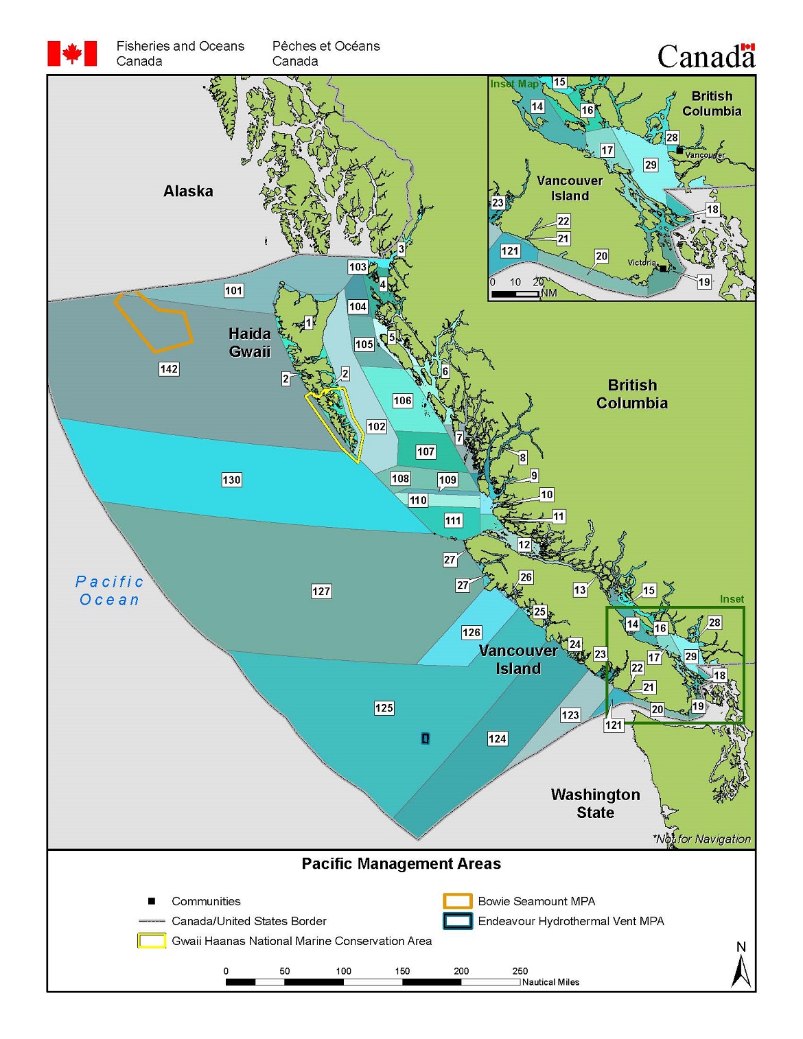
Overview map of Pacific Fishery Management Areas
For a written description of Pacific Fishery Management Areas and Subareas please see the Pacific Fishery Management Area Regulations 2007.
Maps of Pacific Fishery Management Areas
| Area | Description |
|---|---|
| Area 1 | Northern Haida Gwaii |
| Area 2 | Southern Haida Gwaii |
| Area 3 | Portland Inlet |
| Area 4 | Chatham Sound, Porcher Island |
| Area 5 | Greenville Channel, Principe Channel |
| Area 6 | Princess Royal Island |
| Area 7 | Price Island, Hunter Island |
| Area 8 | Fitz Hugh Sound |
| Area 9 | Calvert Island, Rivers Inlet |
| Area 10 | Cranstown Point, Table Island |
| Area 11 | Cape Caution, Westcott Point |
| Area 12 | Northern Johnstone Strait |
| Area 13 | Quadra Island, Cortes Island |
| Area 14 | Oyster River, Parksville |
| Area 15 | Brettell Point, Powell River |
| Area 16 | Texada Island, Lasqueti Island, Jervis Inlet |
| Area 17 | Nanoose Bay, Galiano Island |
| Area 18 | Mayne Island, Saanich |
| Area 19 | Saanich, William Head |
| Area 20 | Sooke, Bonilla Point Lighthouse |
| Area 21/22 | Tzuquanah Point, Nitinat Lake |
| Area 23 | Cape Beale, Ucluelet |
| Area 24 | Cox Point, Estevan Point |
| Area 25 | Nootka Sound, Esperanza Inlet |
| Area 26 | Union Island, Solander Island |
| Area 27 | Solander Island, Lawn Point, Cape Scott |
| Area 28 | Bowen Island, Squamish, Vancouver, Indian Arm |
| Area 29 | Lower Strait of Georgia |
| Area 101 | Open water north of Haida Gwaii |
| Area 102 | Open water east of Haida Gwaii |
| Area 103 | Open water west of Zayas Island and Dundas Island |
| Area 104 | Open water between Rose Point and Chatham Sound |
| Area 105 | Open water west of Banks Island |
| Area 106 | Hecate Strait |
| Area 107 | Hecate Strait/Queen Charlotte Sound |
| Area 108 | Open water west of Calvert Island |
| Area 109 | Open water west of Calvert Island |
| Area 110 | Open water southwest of Calvert Island |
| Area 111 | Open water north of Vancouver Island |
| Area 121 | Open water southwest of Pachena Point |
| Area 123 | Open water southwest of Ucluelet |
| Area 124 | Open water southwest of Clayoquot Sound |
| Area 125 | Open water southwest of Nootka Sound |
| Area 126 | Open water southwest of Clerke Point |
| Area 127 | Open water west of Northern Vancouver Island |
| Area 130 | Open water west of Queen Charlotte Sound |
| Area 142 | Open water west of Haida Gwaii |
- Date modified: