
Glass Sponge Reef Fishery Closure: Langdale
This map is for information only and should not be used for fishing, navigation or other purposes.
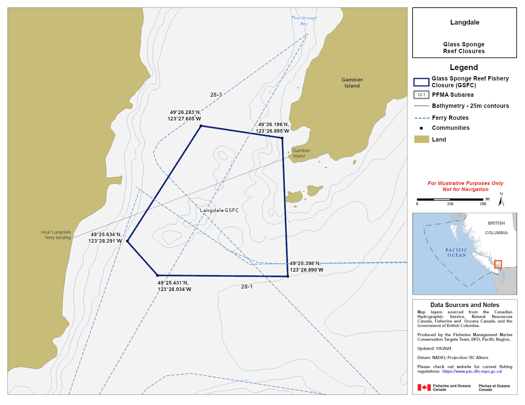
Coordinates and description
Coordinates
That portion of Subarea 28-1 and 28-3 that lines inside a line that:
| begins at | 49⁰ 26.283’N | 123⁰ 27.605’W |
| then southeasterly to | 49⁰ 26.196’N | 123⁰ 26.895’W |
| then southerly to | 49⁰ 25.398’N | 123⁰ 26.890’W |
| then westerly to | 49⁰ 25.431’N | 123⁰ 28.034’W |
| then northwesterly to | 49⁰ 25.634’N | 123⁰ 28.291’W |
| then to the beginning point | 49⁰ 26.283’N | 123⁰ 27.605’W |
Data sources and notes
Map layers sourced from the Canadian Hydrographic service, Natural Resources Canada, Fisheries and Oceans Canada and the Government of British Columbia.
Produced by the Fisheries Management Conservation Targets Team, DFO, Pacific Region.
Updated: 2024-01-08
Datum: NAD 83, Projection: BC Albers
Please check our website for current fishing regulations.
Howe Sound fishing closures to protect glass sponge reefs
Fisheries closures are currently in place to protect and conserve 5 glass sponge reefs in Howe Sound, with the aim of establishing marine refuges in the future. No commercial or recreational bottom-contact fishing activities are allowed.
This includes fishing for:
- prawn by trap
- shrimp by trap and trawl
- crab by trap
- groundfish (including halibut) by trawl and hook-and-line
The use of downrigger gear in recreational salmon trolling is also prohibited in these areas due to the potential risk of damage to the shallower reefs in Howe Sound.
- Date modified: