
Glass Sponge Reef Marine Refuge: Sechelt
This map is for information only and should not be used for fishing, navigation or other purposes.
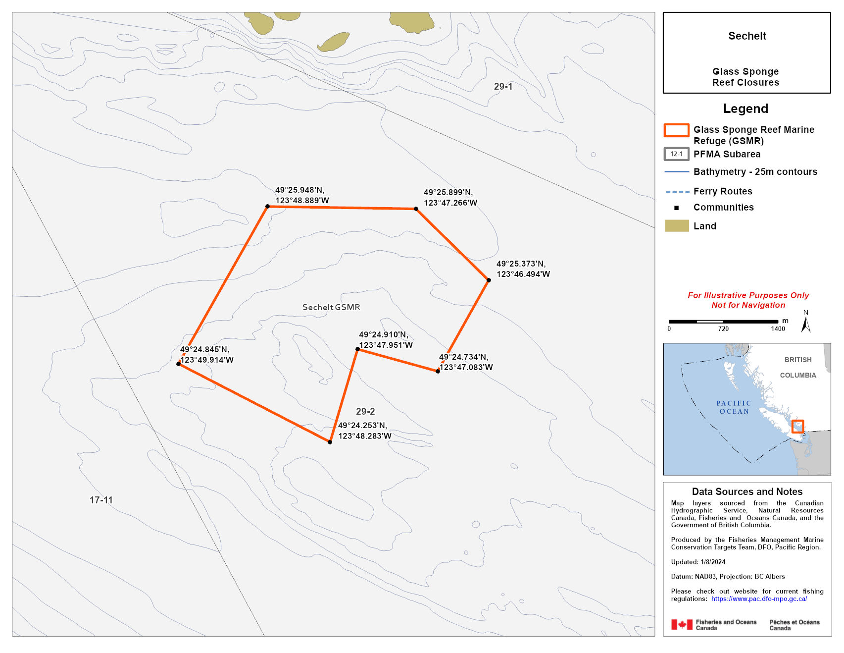
Coordinates and description
Coordinates
That portion of Subarea 29-2 that lies inside a line that:
| begins at | 49°25.948'N | 123°48.889'W |
| then easterly to | 49°25.899'N | 123°47.266'W |
| then southeasterly to | 49°25.373'N | 123°46.494'W |
| then southwesterly to | 49°24.734'N | 123°47.083'W |
| then westerly to | 49°24.910'N | 123°47.951'W |
| then southerly to | 49°24.253'N | 123°48.283'W |
| then northwesterly to | 49°24.845'N | 123°49.914'W |
| then to the beginning point | 49°25.948'N | 123°48.889'W |
Data sources and notes
Map layers sourced from the Canadian Hydrographic service, Natural Resources Canada, Fisheries and Oceans Canada and the Government of British Columbia.
Produced by the Fisheries Management Conservation Targets Team, DFO, Pacific Region.
Updated: 2024-01-08
Datum: NAD 83, Projection: BC Albers
Please check our website for current fishing regulations.
Regulations in Strait of Georgia Glass Sponge Reef Marine Refuges
Following consultations with First Nations, commercial and recreational harvesters, different levels of government, and conservation organizations, we have put in place measures to protect and conserve glass sponge reefs on British Columbia's south coast.
No commercial, recreational or Indigenous Food, Social and Ceremonial bottom-contact fishing activities are allowed.
This includes fishing for:
- prawn by trap
- shrimp by trap and trawl
- crab by trap
- groundfish (including halibut) by trawl and hook-and-line
- Date modified: