
Rockfish Conservation Areas
Area 15 - Copeland Islands - Chart 3513
This map is for information only and should not be used for fishing, navigation or other purposes.
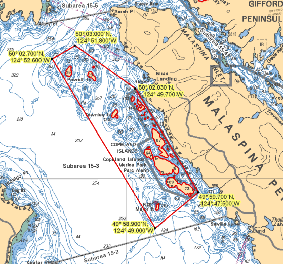
In Subarea 15-3 those waters in the vicinity of the Copeland Islands that lie inside a line that:
| begins at | 50°02.700' N | 124°52.600' W | in water |
|---|---|---|---|
| then to | 50°03.000' N | 124°51.800' W | in water |
| then to | 50°02.030' N | 124°49.700' W | in water |
| then to | 49°59.700' N | 124°47.500' W | in water |
| then to | 49°58.900' N | 124°49.000' W | in water |
then to the beginning point. This includes all the waters of the Copeland Islands Marine Park shown on Chart No. 3538, published by the Canadian Hydrographic Service of the Department.
Regulations
Prohibited fisheries activities
The fisheries activities listed below are restricted in order to help protect rockfish from mortality and to support their conservation. By following regulations in Rockfish Conservation Areas, you are actively helping to protect these species.
Commercial harvesters may not fish for:
- salmon by troll
- groundfish by means of bottom trawl, hook and line, mid-water trawl, or trap
- tuna by hook and line
- shrimp by trawl
Recreational fishers may not fish for:
- any species by spearfishing
- groundfish by angling
- salmon by trolling, jigging or mooching
- octopus by angling
- squid by jigging
Permitted fisheries activities
Some other fisheries activities may be allowed in RCAs. Check our fishery notice system and our sport fishing guide for current details about fishing opportunities, closures and regulations in the area you want to fish in. Make sure you know and follow your conditions of licence every time you head out to fish.
The use of descending devices is mandatory when recreational anglers release rockfish. Learn more about barotrauma and how you can help protect rockfish.
Related links
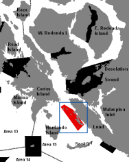
Click on the map above to see other RCAs in this region.
- Date modified: